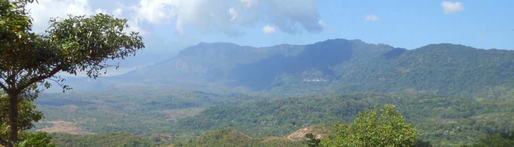
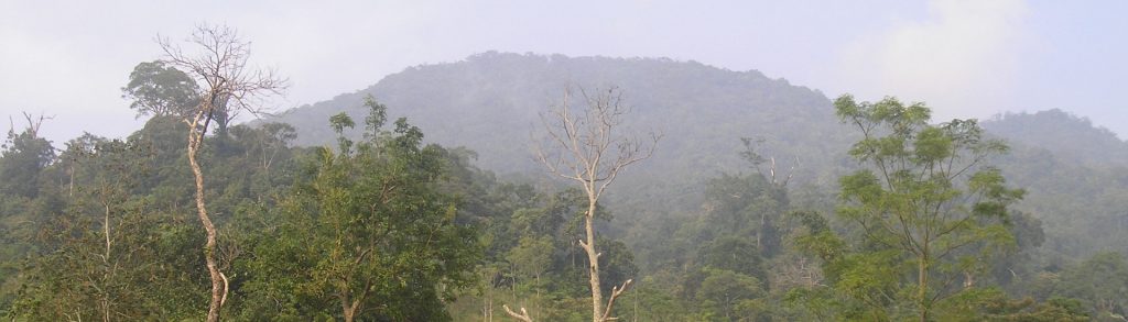
Author name: Dan

Sapathawung West

Facts Elevation: 1,906 m (6,253 ft) Prominence: 1,428 m Ribu category: Kurang Tinggi Province: Kalimantan Tengah (Central Kalimantan) Google Earth: kml Rating: Other names: Sapat Hawung Bagging It! We currently know very little about this mountain. Please contact us if you can help provide some information. It’s part of the Bukit Sapat Hawung Nature Reserve […]

Sapathawung West Read More »

Tutoop

Facts Elevation: 1,220 m (4,003 ft) Prominence: 1,156 m Ribu category: Kurang Tinggi Province: Kalimantan Barat (West Kalimantan) Google Earth: kml Rating: Other names: Toetoop on old maps, possibly known as Ngaras Photos Bagging It! We currently know very little about this peak – please contact us if you can provide any information. Practicalities Getting

Tutoop Read More »

Sebayan

Facts Elevation:1,377 m (4,518 ft) Prominence: 1,175 m Ribu category: Kurang Tinggi Province: Kalimantan Barat (West Kalimantan) Google Earth: kml Rating: Other names: none Bagging It! This mountain, also known as Bukit Sebayan, can be hiked from Desa Riam Dadap, though it is only rarely climbed by student hiking clubs and it is not clear

Sebayan Read More »

Batutenobong

Facts Elevation: 1,580 m (5,183 ft) Prominence: 1,191 m Ribu category: Kurang Tinggi Province: Kalimantan Barat (West Kalimantan) Google Earth: kml Rating: Other names: none Bagging It! We currently know very little about this peak – please contact us if you can provide any information. Practicalities Getting there: Unknown Accommodation: Unknown Permits: Unknown Water sources:

Batutenobong Read More »

Lawit

Facts Elevation: 1,767 m (5,797 ft) Prominence: 1,128 m Ribu category: Kurang Tinggi Province: Kalimantan Barat (West Kalimantan) Google Earth: kml Rating: Other names: none Bagging It! We currently know very little about this peak – please contact us if you can provide any information. Practicalities Getting there: Unknown Accommodation: Unknown Permits: Unknown Water sources:

Lawit Read More »

Doro Pundunence

Facts Elevation: 1,433 m (4,701 ft) Prominence: 1,289 m Ribu category: Kurang Tinggi Province: Nusa Tenggara Barat Google Earth: kml Rating: Other names: Formerly listed as Doro Maria. A grassy spot 3km away at 1,050m is known as Pundu Nence to local campers. Photos Bagging It! According to the Bakosurtanal map, the highest point of

Doro Pundunence Read More »

Tondongkarambu

Gunung Tondongkarambu is the highest mountain in the Bantimurung – Bulusaraung National Park area which was first explored by Alfred Russel Wallace in 1857 and is the second largest karst area in the world. Good hiking options in this very picturesque region include both Tondongkarambu and the more popular and shapely Bulusaraung. Apparently there is a small village named Tobalo in a remote part of the national park whose inhabitants are eleven albinos. It is said that this number must stay the same, so should one inhabitant die, a new albino from outside must come and take his or her place.

Tondongkarambu Read More »

Batanta (Kalaikut)

Facts Elevation: 1,184 m (3,885 ft) Prominence: 1,184 m Ribu category: Kurang Tinggi Province: Papua Barat (West Papua) Google Earth: kml Rating: Other names: Gunung Yakut on the Bakosurtanal map. Bagging It! This Ribu is the highest point of Batanta island which lies off the north coast of mainland West Papua. Much of the island

Batanta (Kalaikut) Read More »

Tanggamus

Facts Elevation: 2,102 m (6,896 ft) Prominence: 1,382 m Ribu category: Tinggi Sedang Province: Lampung Google Earth: kml Rating: Other names: none Photos Bagging It! Gunung Tanggamus dominates the landscape around Kota Agung on the beautiful, scenic western coast of Lampung. From Kota Agung it appears as a pyramid of jungle with broad lower slopes

Tanggamus Read More »

Buku Rica (Meng)

Facts Elevation: 1,155 m (3,789 ft) Prominence: 1,132 m Ribu category: Kurang Tinggi Province: Maluku Utara (North Moluccas) Google Earth: kml Rating: Other names: Gunung Meng, Buku Raroang Photos Bagging It! We currently know very little about this peak – please contact us if you can provide any information. US Army map lists the peak

Buku Rica (Meng) Read More »

Scroll to Top