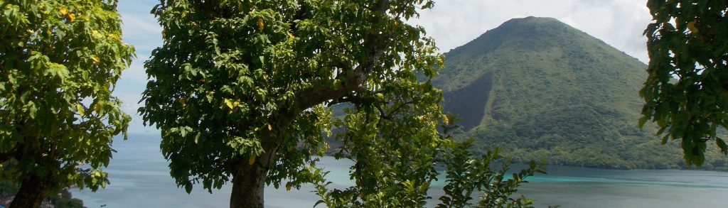
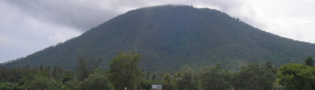
Spesial

Tajam

TAJAM

Gunung Tajam is the highest mountain range on the pleasant island of Belitung. Just as on neighbouring Bangka island, there are two peaks of very similar height in the range. However, they can both easily be bagged in half a day from the capital of Tanjung Pandan and nearby beach resorts.

Tajam Read More »

Maras (Bui)

Facts Elevation: 705 m (2,313 ft) Prominence: 705 m Ribu category:Spesial Province: Bangka Belitung Google Earth: kml Rating: Other names: Bui sometimes spelt with a ‘k’ = Buik or ‘h’ = Buih Photos Bagging It! Gunung Maras is the name given to the largest mountain range on the island of Bangka. Whilst not especially high

Maras (Bui) Read More »

Samosir

Facts Elevation: 1,698 m (5,571 ft) Prominence: 791 m Ribu category: Spesial Province: Sumatera Utara (North Sumatra) Google Earth: kml Rating: Other names: none Photos Bagging It! This peak is the highest point on the volcanic island of Samosir, which lies within the vast Toba caldera complex – a landscape formed 74,000 years ago by

Samosir Read More »

Pusuk Buhit

Facts Elevation: 1,982 m (6,503 ft) Prominence: 810 m Ribu category: Spesial Province: Sumatera Utara (North Sumatra) Google Earth: kml Rating: Other names: none Photos Bagging It! This lovely mountain is located near Pangururan just to the west of Samosir island and Lake Toba. It is best known for the (very) hot springs (Aek Rangat)

Pusuk Buhit Read More »

Banda Api

BANDA API

Banda Api is a small but very active island volcano in the remote Banda islands. It has been observed and written about for centuries since it was a key location for the trading of spice when the British, Dutch and Portuguese sought the vast quantities of nutmeg on these islands – particularly Run / Rhun island. The last major eruption was in 1988 but there remains minor fumarole activity near the summit.

Banda Api Read More »

Wayang-Windu

Wayang-Windu is a twin volcano that consists of Mount Wayang (“Mount Shadow”) and Mount Windu. Wayang is the higher of the two peaks and, although both peaks have active side craters, Wayang is the more interesting. The northern ridge offers some of the most demanding hiking terrain (and most fabulous views) in the whole of West Java. Legend has it that an emperor from the ancient Sundanese kingdom of Pajajaran is buried on the middle peak.

Wayang-Windu Read More »

Rokatenda

Facts Elevation: 875 m (2,871 ft) Prominence: 875 m Ribu category: Spesial Province: Nusa Tenggara Timur Google Earth: kml Rating: Other names: Paluweh Eruptions: 1650, 1928, 1963-66, 1972-73, 1980-81, 1984-85, 2012-13 Bagging It! Paluweh volcano, also known as Rokatenda, forms the 8-km-wide island of Paluweh north of the volcanic arc that cuts across Flores Island.

Rokatenda Read More »

Buringayok

Facts Elevation: 1,202 m (3,944 ft) Prominence: 987 m Ribu category:Spesial Province: Kalimantan Timur (East Kalimantan) Google Earth: kml Rating: Other names: none Bagging It! We currently know very little about this peak – please contact us if you can provide any information. Practicalities Getting there: Unknown Accommodation: Unknown Permits: Unknown Water sources: Unknown Local

Buringayok Read More »

Sebesi

This 844m high island lies in the Sunda Strait just 12km north of the Krakatau islands and is usually accessed by boat from Canti near Kalianda, Lampung. It’s a really peaceful environment and quite popular with visitors from the Sumatran mainland. Despite its calm atmosphere today, the island was devastated by the Krakatau eruption and it is hard to find a tree on the island which predates the catastrophic events of 1883. It’s a great long weekend break from Jakarta.

Sebesi Read More »

Scroll to Top